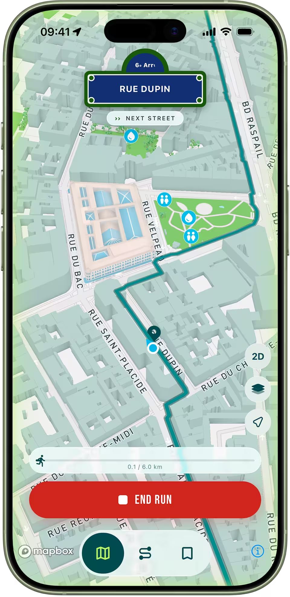
Running Mode
A clean, focused view for when you start running. A live blue dot follows you in real time — no clutter, just your trace, your pace, and turn-by-turn cues.

Generate AI-powered running routes in Paris, scored by parks, trees, sidewalk width, and pedestrian zones — then hit the streets with a live map, blue dot and clear trace that keeps you always on track.
In 3 steps
Enter an address and let our AI algorithm generate the perfect route. Choose between Loop or Itinerary mode.

Get your generated routes displayed directly on the map alongside their overall scores.
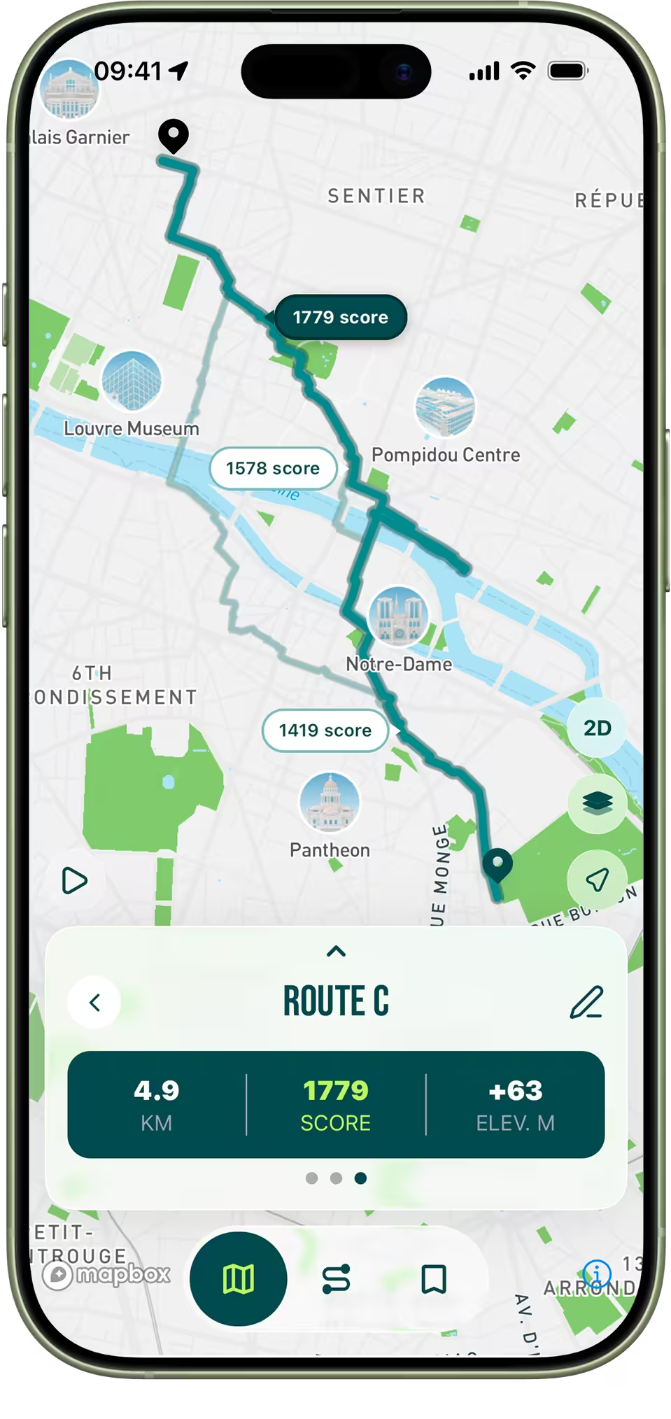
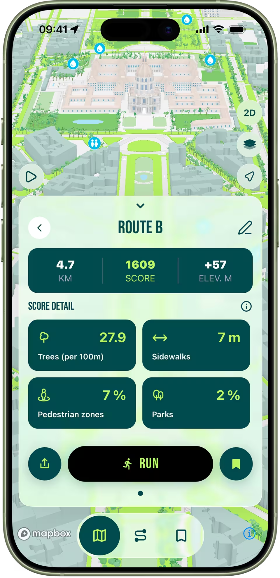
Get a detailed breakdown and analysis of each route to easily pick the one that fits you best.
Features
Discover why RunninParis is much more than just a map.
A clean, focused view for when you start running. A live blue dot follows you in real time — no clutter, just your trace, your pace, and turn-by-turn cues.

Fly through your route in stunning 3D before you run it. Get familiar with turns, landmarks and streets so there are no surprises.

Every route is scored from official Paris open data: sidewalk width, tree density, pedestrian zones, parks and more.

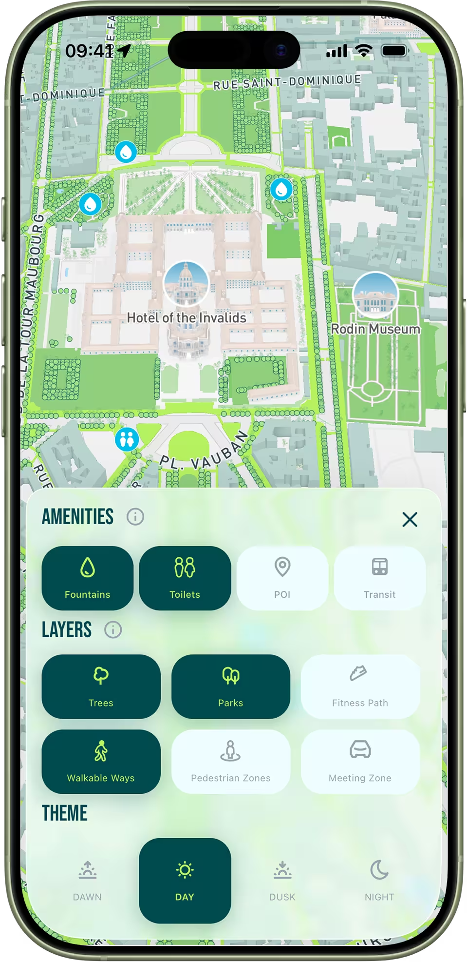
Explore a map of Paris built specially for runners. Toggle amenities, overlays and themes to create your personalized running map.
Not all streets run the same. Get a detailed breakdown of each score and a comparison diagram to pick the route that fits you best.

Two ways to build: a loop that brings you back to your starting point, or a point-to-point itinerary between two addresses. The AI optimises either for you.

Save your favourite routes and build a personal library you can pull up before any run — distance, score and start point in one tap.
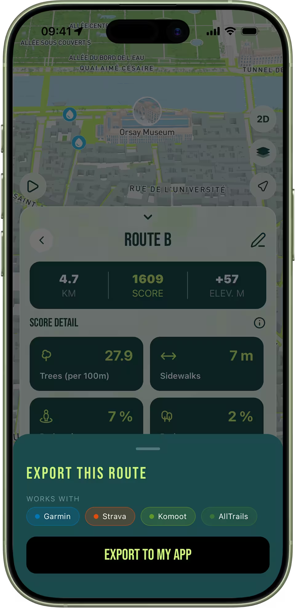
Export any route as a GPX file to Strava, Garmin, Komoot, AllTrails or your watch for turn-by-turn navigation on the go.
Under the hood
Two dedicated pages explain the science behind RunninParis.
Every street in Paris evaluated by parks, trees, sidewalk width, pedestrian zones and more — using official city open data.
Amenities, data layers, and everything you can toggle on the dedicated running map of Paris.
The journal
Guides, route ideas and methodology. New articles every week.

From the Bois de Boulogne to the Promenade Plantée, a runner-first guide to the green spaces that change how you train in Paris.

The two banks of the Seine offer the longest car-free urban riverside run in mainland Europe. A complete guide to the route, the bridges and the timing.
Paris has quietly become one of the most walkable major cities in Europe. A complete runner's guide to its pedestrian corridors, market streets, arcades and meeting zones.
FAQ
Everything you need to know before your first run.
Ready, set, run
Free on iOS & Android — no account, no subscription.