3–6 routes, you choose
Compare score, elevation & distance.
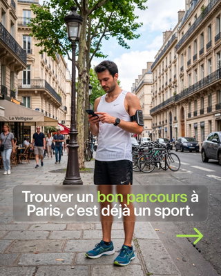
Custom running routes scored from the City of Paris's own data — plus a runner's map with water fountains, toilets and live tracking. Everything for the run, in one app.
In 3 steps
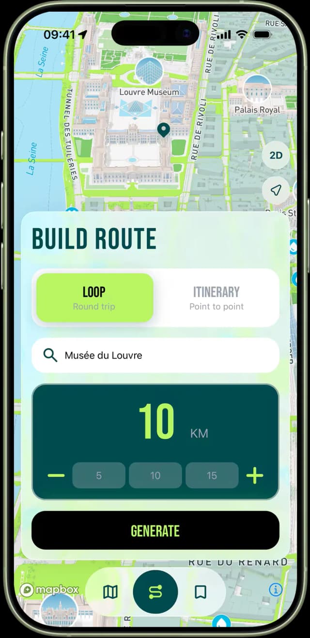
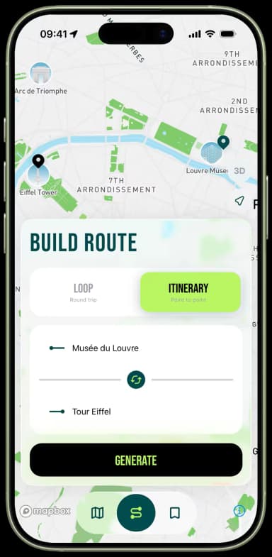
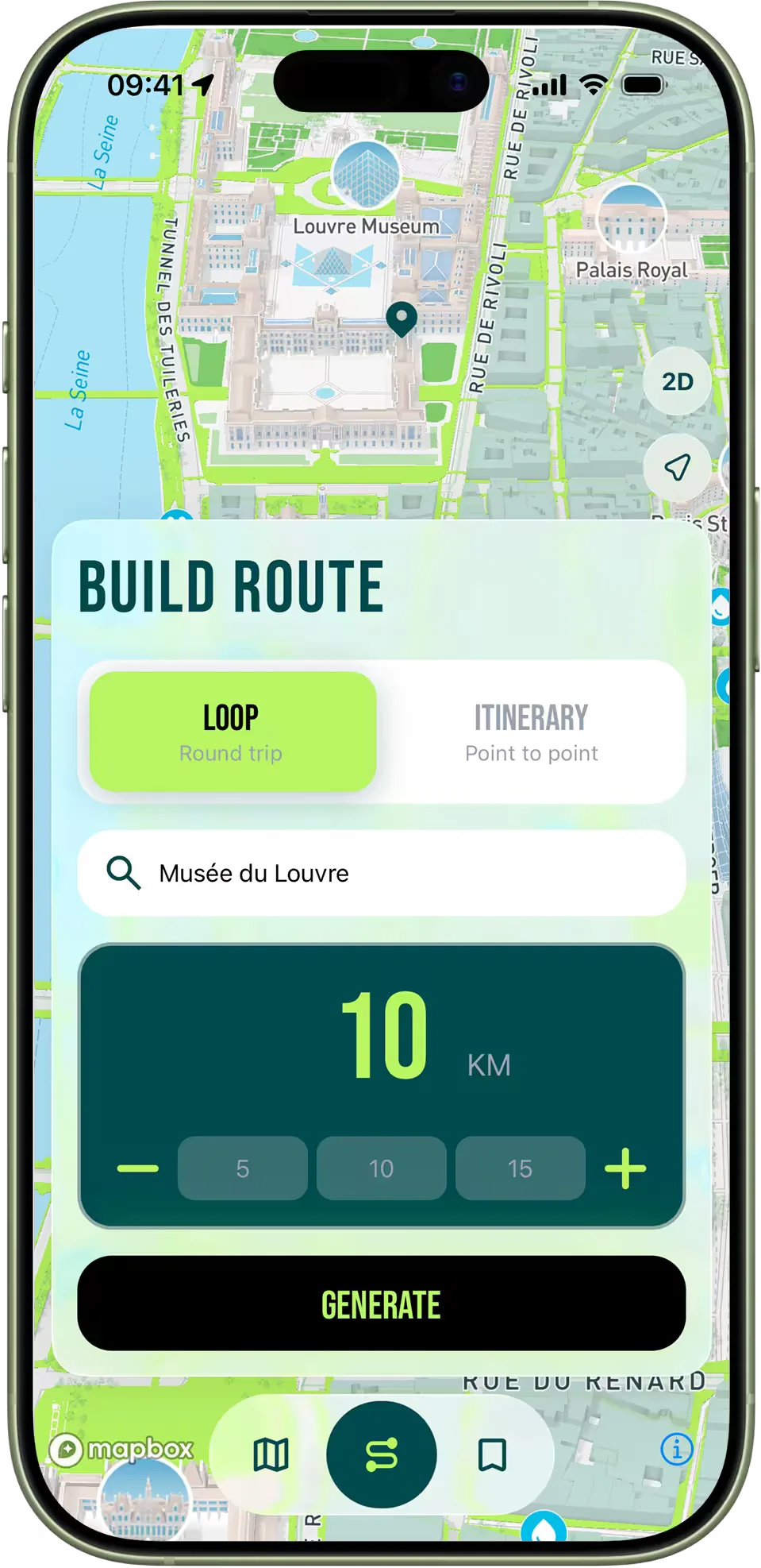
Enter an address and your distance — our algorithm builds the route. Choose Loop, Itinerary, or the new Culture mode to run past the city's landmarks.
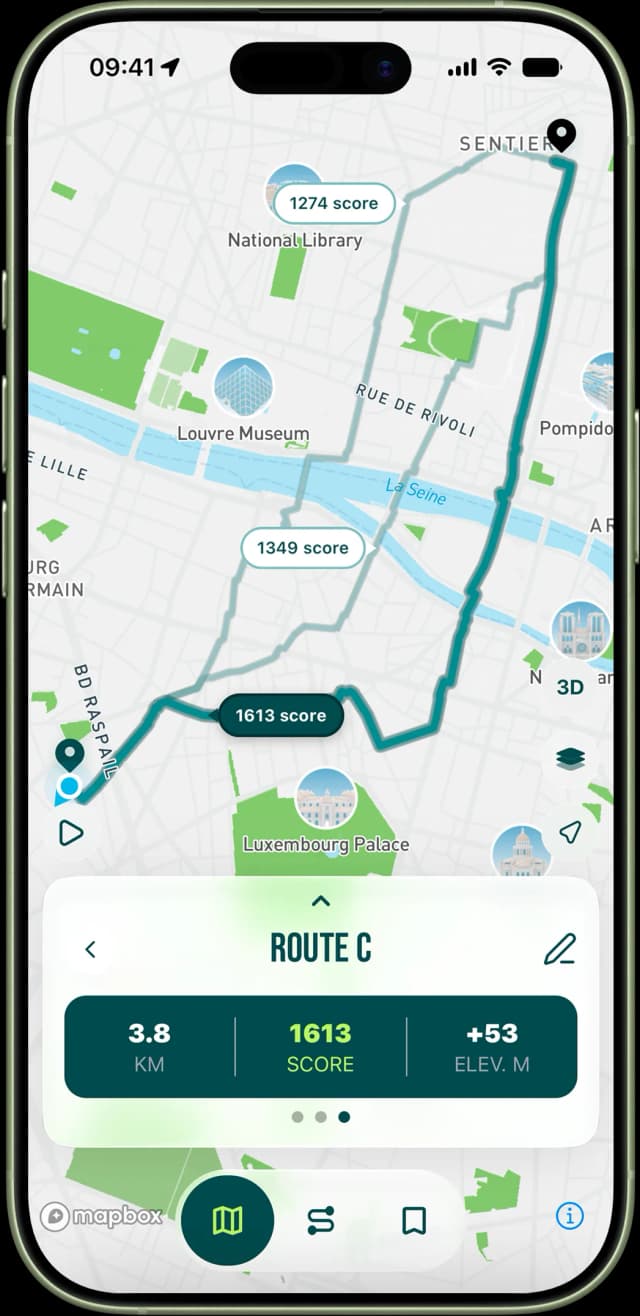
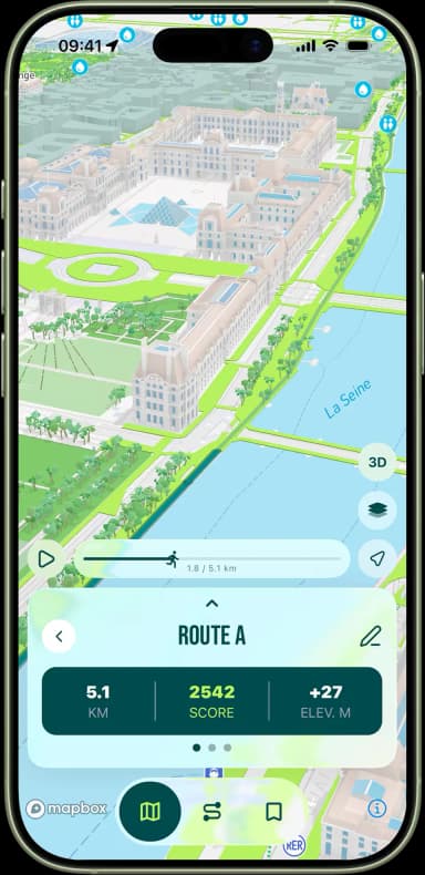
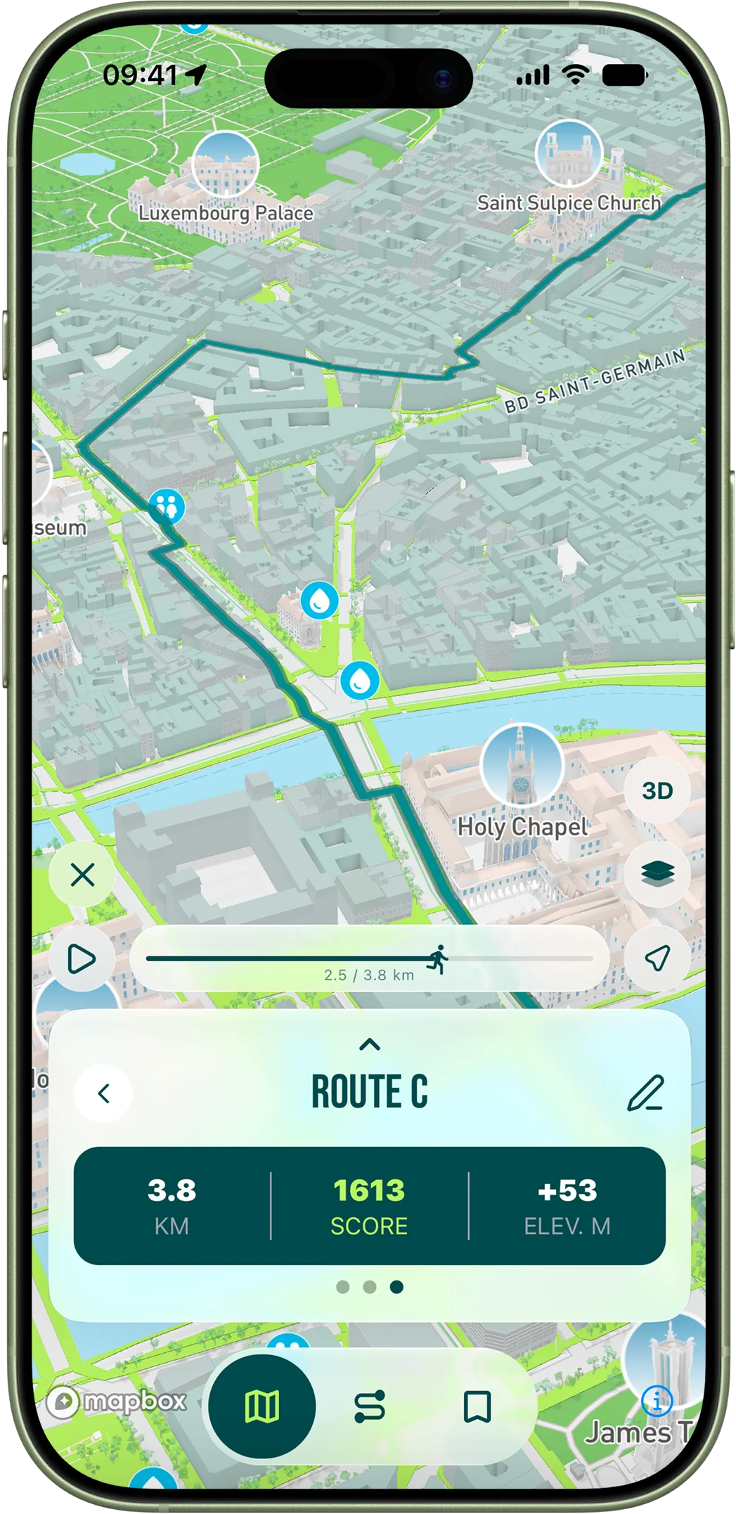
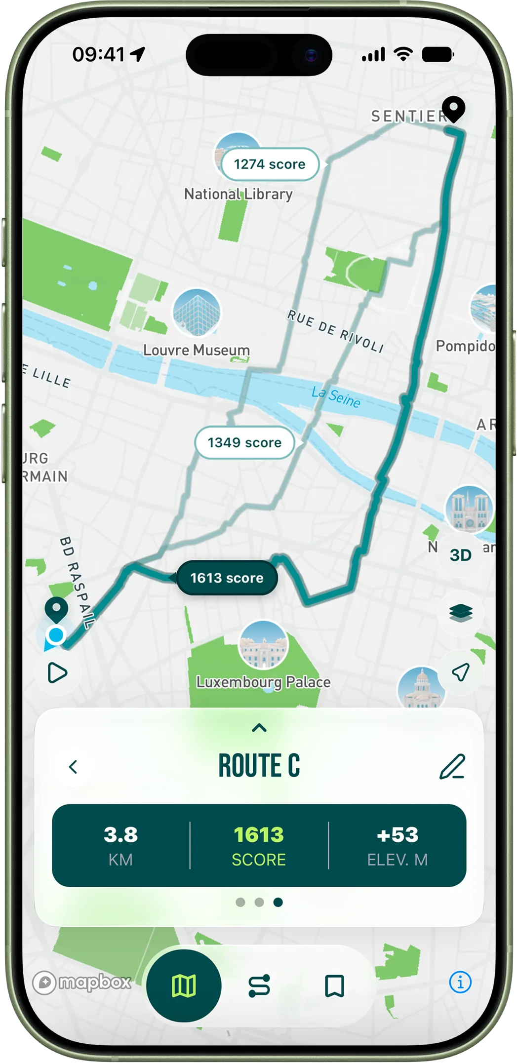
Your generated routes appear right on the map, each with its overall score from the City of Paris open data.
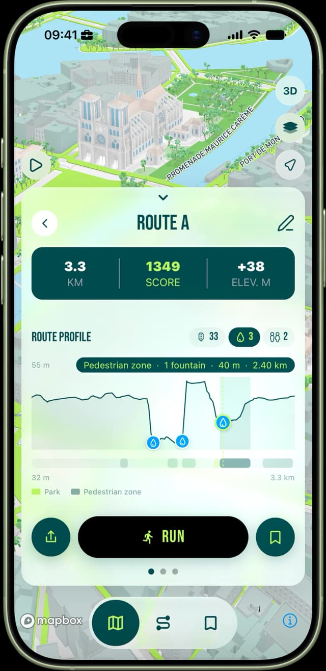
See the breakdown of each route — its stretches through parks and pedestrian zones, the elevation, and the crossings, fountains and toilets along the way — then pick the one that fits you best.
Features
Generate it, compare it, run it — everything for the run in one app.
Compare score, elevation & distance.
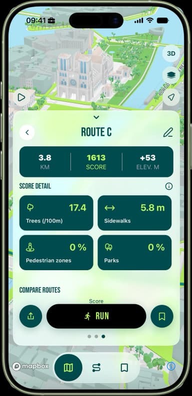
% parks, pedestrian zones, trees, sidewalks.
Ask 10k, run 10k.
Fly through your route in 3D before you head out.
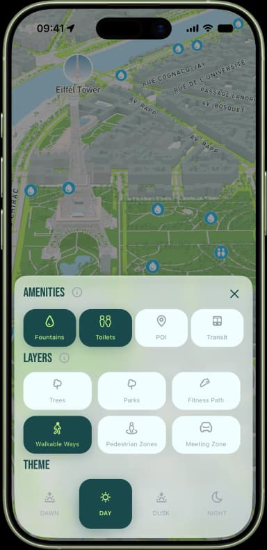
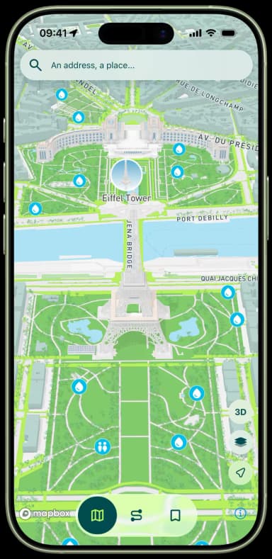
Explore a map of Paris built specially for runners. Toggle amenities, overlays and themes.
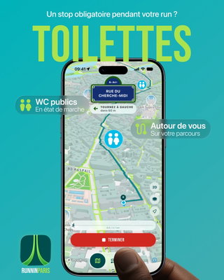
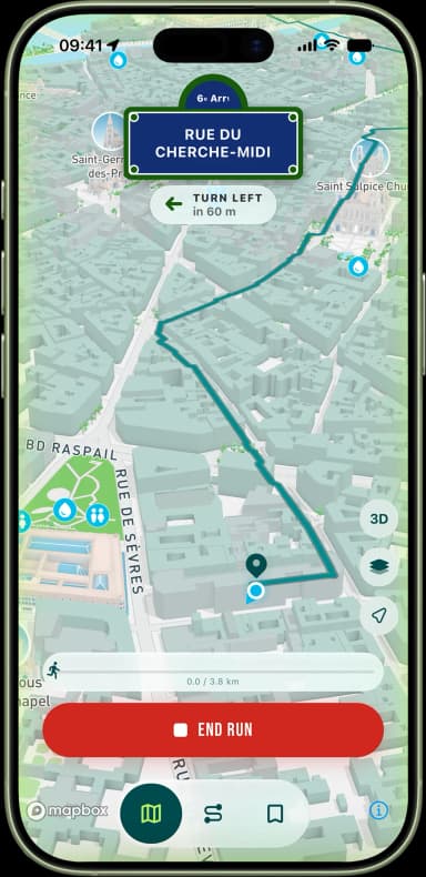
Live blue dot, drinking fountains & toilets on route.
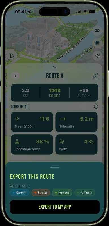
One-tap GPX to Garmin, Strava, Komoot & more.
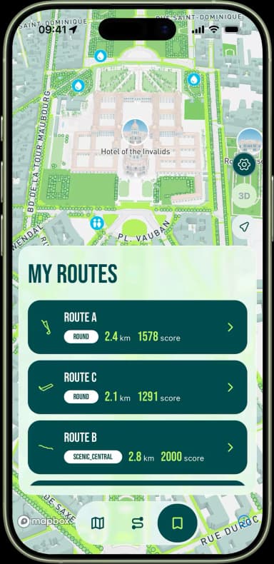
Save the runs you love and find them again in a tap.
Explore Paris on a 3D map colour-coded by running score.
Run smarter, today
Culture mode builds a run past the city's monuments, commemorative plaques and must-see sites — the same scored routing, now showing you the Paris you run past every day. Each place comes with its story on swipeable cards.
Discover Culture mode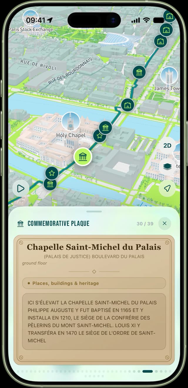
Under the hood
Two dedicated pages explain the science behind RunninParis.
Every street in Paris evaluated by parks, trees, sidewalk width, pedestrian zones and more — using official city open data.
Amenities, data layers, and everything you can toggle on the dedicated running map of Paris.
The journal
Guides, route ideas and methodology. New articles every week.
Every arrondissement has a good run hiding in it — if you know where to look. A practical map of where to run in Paris, wherever you are staying or living.
Ten kilometres is the benchmark distance, and Paris has more good 10K loops than almost any capital. Five we keep coming back to — and how to build your own.
From the Bastille to Pantin, the canal towpaths give you ten kilometres of flat, lit, traffic-free running. Here is how to run them well, and when to avoid them.
FAQ
Everything you need to know before your first run.
Ready, set, run
Free on iOS & Android — no account, no subscription.